Cache number 40 pending, and a lazy overcast day with no plans provided the perfect opportunity for a family hunt. Deciding to head down to a multi cache called ‘Rocks on Rocks’ at Umina, as I had already obtained the numbers required from the first way point. Using these to decrypt the coordinates of the 2nd waypoint, I knew we were heading to the end of the rocky headland to get 3 more numbers to apply in order to get the 3rd and final location. Looking at the code, I was able to work out 2 of the 3 numbers pretty easily, simply by using my existing knowledge of coordinates for the area. This mean that with a bit of a play around with the geo-checker I also had the final coordinates in hand – after chatting online with the geo-bro that morning about general geo-caching matters, I was now aware of how to enter all these coordinates into c:geo, giving me one map with all the marked locations, so I played around and did this, more to know how to use the function for future reference, rather than to utilise for this particular cache.
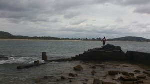
We headed off to What is locally known as ‘Kiddy Corner’, the unpatrolled end of the beach, where there is a small lagoon area, and an off-leash area for dogs. Being able to bypass both waypoints, I sorted the compass to point us to GZ and we headed off rock hopping and exploring the rocky headland, in search of a “rock from mars”.

Along the way, another group of rock-hoppers had spotted some little crabs, so we stopped to look:
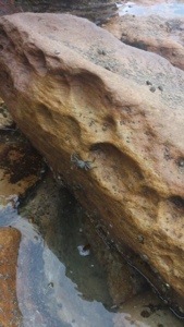
The crabs were obviously guarding the cache, because when I switched my phone back from the camera to the compass, it swung around, and told me GZ was 1.2m behind me. I turned around, and spotted a rocky ledge, which was described in the hint.

Scrambling up toward it to have a closer look, I spotted something white under a rock – looking like a thin plastic name badge, my mind tried to tell me it was too small for the cache, but then when I thought twice about it I knew I had to take an even closer look, so I grabbed it and on picking up, saw it was indeed a cleverly hidden cache!
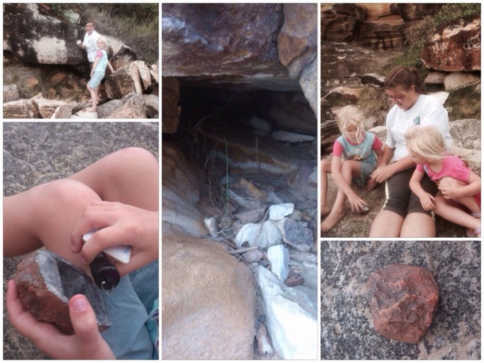
Opening the rock key-hider exposed a small bison tube, containing a small Log for signing – I think the kids were disappointed there was no room for swaps, but they happily enough indicated they wanted to continue rock hopping, so I quickly rebid the cache and rejoined them. Along the way we found a nice spot, where at some point there must have been an ocean bath, but is now clearly a good spot for the fisher-people. Personally, I loved the geometric formations appearing alongside all the naturally formed stuff.
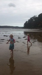
After the rock hop, we returned to the beach, where the girls enjoyed a run on the almost empty beach
Cache name: Rocks on Rocks (GC4QX5O)
Location: Umina Beach, Central Coast, NSW
Find number: 40 🙂
Date found: 9th January 2014
Found with: the geo-family
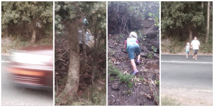
As we returned to the car, I was switching off the GPS when I noticed a cache located 37m south. That couldn’t be right, could it? I looked across the road from where we had parked the car and saw a almost vertical hill/escarpment. Looking at the details for the cache, it seemed like a fairly straight forward scramble up to grab a container that, according to the photo clue, was poking out of a crack between 2 rocks. It described crossing the road directly in front of the power pole (next to our parking spot) and looking across the road again, I could see the geo-trail. It looked difficult, but I felt I at least needed to cross the road and see. Jorja was looking over my shoulder, and keen for another treasure find too, and despite several warnings from me that it was a VERY steep climb (at the edge of a busy road) and reassurance I would bring the treasure back to the car if I found it, she would not be convinced to stay behind at the car with Jen and Summer, so we waited for a good break in the traffic and darted across the road and into the bush.
As soon as we hit that side of the road we had no choice but to go up – the first 3 or 4 steps were ok, around a large rock and tree trunk, but then it was pretty much a rock climb upwards. Jorja, slightly ahead of me gingerly climbed a few more meters and was able to see inside the lowest crack (of 3 we could see) – not seeing anything, and feeling a little nervous by now, I assisted her to negotiate her way back down to a ‘resting’ point, while I attempted to climb a little higher….making it to the 2nd spot and finding nothing there, I looked for another foothold, but could not locate anything further that was safe enough to negotiate in my thongs (not exactly rock climbing footwear!) so I too gingerly headed back down. Reaching Jorja, we together ran back across the road, with a DNF to log (not that I minded in the least with this one!)
After returning home, I was again chatting to the geo-bro online…when I told him about the attempt we made he immediately demanded to know the terrain rating….looking it up (because I hadn’t even bothered to look at this earlier!) I found it was rated 4/5 (!)
…his reply came “geezuz Kel! Be careful!!”….hmm, whoops 🙂
